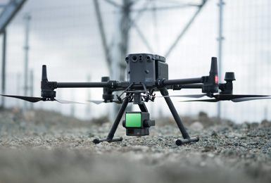
LIDAR (Light Detection and Ranging) is a remote sensing technology that uses laser light to measure distance and create highly accurate 3D maps of the Earth’s surface. LIDAR-based survey services offer a precise and efficient way to collect data for various applications, including
- Topographic mapping : Creating detailed maps of the terrain, including elevation, vegetation, and land use.
- Urban planning : Assessing urban development, infrastructure planning, and environmental impact studies.
- Construction Monitoring construction progress, measuring volumes, and detecting changes in the environment.
- Geology : Studying geological formations, fault lines, and natural hazards.
- Forestry : Measuring tree height, density, and biomass.
- Archaeology : Discovering and documenting archaeological sites.
Advantages of LIDAR-based survey services
- High accuracy :LIDAR provides highly accurate measurements, even in challenging environments.
- Efficiency :: LIDAR can collect data over large areas quickly and efficiently.
- VersatilityLIDAR can be used for various applications across different industries.
- Data richness : LIDAR data provides detailed information about the Earth's surface, including elevation, vegetation, and land use.
- Non-invasive : : LIDAR is a non-destructive method that does not require physical contact with the environment.
- Archaeology : Discovering and documenting archaeological sites.
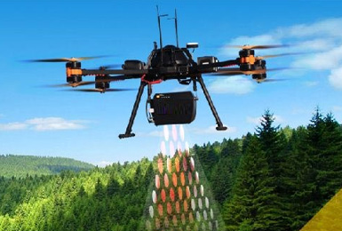
How LIDAR works:
- 1.Laser pulsesy A LIDAR system emits laser pulses towards the target surface.
- 2.Time of flight : The system measures the time it takes for the laser pulses to return.
- 3.Distance calculation: Based on the time of flight, the system calculates the distance to the target surface.
- 4.3D point cloud: :: A dense point cloud of 3D coordinates is created, representing the surface topography.
Applications of LIDAR-based survey services
- Urban planning : Assessing urban development, infrastructure planning, and environmental impact studies.
- Construction : : Monitoring construction progress, measuring volumes, and detecting changes in the environment.
- Geology:Studying geological formations, fault lines, and natural hazards.
- Forestry :Measuring tree height, density, and biomass.
- Archaeology :Discovering and documenting archaeological sites.
LIDAR-based survey services are becoming increasingly important in various industries due to their accuracy, efficiency, and versatility. As technology continues to advance, we can expect to see even more innovative applications of LIDAR in the future